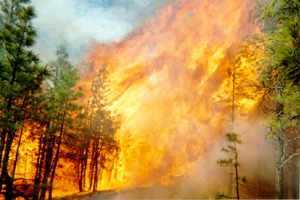
Historically, around 10 million acres are charred by wildland fires each year in the United States. The October 2007 firestorm in Southern California destroyed around 1,500 homes and resulted in 9 deaths, consuming over 500,000 acres. In 2008, almost 1.4 million acres were lost to California wildfires. 2012 acreage burned includes 1.5 million acres in Idaho, 1.3 million in Oregon, and over 800,000 in California. The causes of wildland fires are numerous: lightning, carelessly discarded smoking materials, campfires, fireworks, conductor clashing or interaction of overhead electrical utilities with vegetation, motor vehicles, hot work/welding, and arson.
Wildland and Wildland Urban Interface fire risk modeling and mapping.
In 2010, Reax Engineering was retained by AT&T, Verizon, Cox Communications, and other members of the California Communication Infrastructure Provider (CIP) Coalition to develop a wildland fire risk model to quantify the fire hazard associated with CIP facilities that are co-located with overhead electrical utilities (power lines). High-resolution wind and weather modeling of historical severe fire weather events, combined with statewide rasters of fuel and topography data, were provided as input to a wildland fire spread model that was developed specifically for this project and used to identify areas of California at elevated risk of experiencing catastrophic wildland fires.  This “CIP Fire Threat Map”, sometimes called the “Reax Map”, was presented to the California Public Utilities Commission (CPUC) and accepted on an interim basis for CIPs to identify high fire risk areas. Since that time, Reax Engineering has been retained by a major electrical utility to develop a wildland fire model for simulating rapidly-spreading wind-driven fires that historically have led to large losses in Wildland Urban Interface areas. This model is used to identify areas at elevated risk of experiencing catastrophic wildland fires ignited by overhead electrical utilities.
Wildland fire modeling.
Wildland fire modeling tools are available to analyze surface fire spread and fire spotting. Such tools provide valuable information regarding fire development, and can be used to answer “what if” questions related to fire development and spread, effectiveness of fuels treatments, effect of wind and weather on fire propagation, etc. In forensic investigation of wildland fires, wildland fire modeling tools can be used as part of the hypothesis testing guidance of NFPA 921, Guide for Fire and Explosion Investigations, to assess whether or not a postulated specific origin area is consistent with observed fire patterns. One of the outputs of wildland fire modeling is a spatial and temporal description of the fire front, an example of which is shown below:

Wind and weather analysis and modeling.
In some (but not all) cases, topography can affect wind patterns and subsequent fire development. Wind and weather data can be obtained from Remote Automated Weather Stations (RAWS), as well as gridded data products produced by various meteorological organizations, such as the North American Regional Reanalysis (NARR) dataset. Local wind and weather patterns at the time of a fire can be recreated using tools such as the Weather Research and Forecasting (WRF) and Fire Dynamics Simulator (FDS) models, both of which are used at Reax Engineering on a regular basis.
